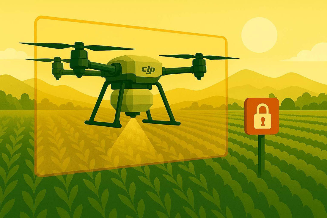
How to Set Up Geofencing for DJI Agras Drones
Geofencing for DJI Agras drones creates GPS-based boundaries to manage where your drone can fly. It’s a key feature for agricultural drone operators to ensure compliance with airspace regulations, improve safety, and optimize efficiency. Here’s a quick overview of the process:
- Update Firmware and Apps: Ensure your drone and DJI apps are running the latest versions for geofencing features.
- Create a DJI Account: Required to access geofencing tools and request access to restricted zones.
- Review Airspace Rules: Understand FAA and local regulations, especially if spraying chemicals or operating near restricted zones.
- Configure Geofencing Settings: Use the DJI Fly Safe portal to set up boundaries, check restricted zones, and request permissions if needed.
- Understand Zone Types: DJI uses color-coded maps (red, blue, gray, yellow) to indicate different levels of restrictions.
- Request Access for Restricted Zones: Submit unlock requests through the Fly Safe portal with proper documentation.
Geofencing helps protect privacy, avoid restricted areas, and align with regulations, but it requires careful planning and operator responsibility. Always stay updated on rules and ensure your drone is ready for safe, compliant flights.
How to Unlock DJI Geofencing Using the GEO System
Getting Ready for Geofencing Setup
Before diving into geofencing setup for your DJI Agras drone, it’s essential to complete a few preparatory steps. These will ensure your drone operates both safely and within legal boundaries. By addressing these tasks upfront, you’ll save time and avoid potential headaches later on. Start by making sure your drone’s systems and accounts are updated and ready to go.
Update Firmware and Software
Keeping your firmware and app updated is critical for accessing the latest geofencing features and security enhancements. Running outdated firmware can block access to essential safety tools and may interfere with geofencing functionality.
To update, connect your flight app to the internet and look for the FlySafe pop-up notification. Once it appears, click 'Update' to initiate the firmware update. This will refresh the geofencing database and update safety protocols.
Next, check the DJI GO app or DJI Fly app on your mobile device or tablet. These apps are your main tools for configuring geofencing settings, so having the latest version installed is key. Check your app store regularly, as DJI frequently rolls out updates to improve their geofencing systems.
The entire firmware update process typically takes 10–15 minutes, depending on your internet speed. Make sure your drone’s battery is fully charged to avoid interruptions during the update.
Once everything is updated, you’re ready to move on to setting up your DJI account.
Set Up Your DJI Account
A DJI account is necessary to access Fly Safe features and manage geofencing settings. This account also allows you to request access to restricted zones when needed.
To create your account, visit the DJI Fly Safe portal on the DJI website. The account you set up here will also work with your DJI flight app, ensuring a seamless experience across all DJI platforms.
For the best experience, use a desktop or laptop to navigate the Fly Safe portal. The larger screen makes it easier to view geofencing maps and zone details.
A key change took effect on January 13, 2025, when DJI updated its geofencing system for most drones in the U.S. Instead of automatically blocking flights in restricted areas, pilots now encounter Enhanced Warning Zones (formerly called Restricted Zones). This change puts the responsibility for compliance on drone pilots, giving them the choice to proceed or not in these zones.
Review FAA and Local Airspace Rules
Before configuring geofencing, take time to review federal and local aviation regulations. Following these rules not only ensures compliance but also optimizes your drone’s performance. As an agricultural drone operator, you’re subject to multiple regulatory frameworks, and it’s your responsibility to stay informed.
Under 14 CFR Part 107, you’ll need a Remote Pilot Certificate, which requires passing an aeronautical knowledge test and completing a security screening. This certification covers essential airspace knowledge and safety protocols.
If you’re using your DJI Agras drone for chemical spraying, additional certifications are required. Specifically, you’ll need a Part 137 Agricultural Aircraft Operator Certificate. For drones weighing over 55 pounds, you’ll also need an exemption from certain Part 137 regulations.
State-specific rules add another layer of complexity. Most states require an aerial commercial applicator license to spray chemicals from a drone. These requirements vary widely, so it’s crucial to research the regulations in your operating area.
The FAA and EPA jointly regulate agricultural drone operations involving chemical spraying, making it a complex regulatory landscape. New federal rules may introduce stricter requirements for pilot experience, proximity to people and property, and geofencing compliance. Staying updated on these changes is vital.
Before customizing geofencing settings, review the latest FAA rules and local airspace restrictions for your operating area. This ensures your configurations align with legal requirements and helps you avoid fines or operational setbacks.
Setting Up Geofencing on DJI Agras Drones
Once your drone is updated and your account is ready, it’s time to set up the geofencing settings. DJI’s Fly Safe Geospatial Environment Online (GEO) framework uses GPS coordinates to create virtual boundaries around sensitive areas. This system gives you, the operator, the tools to ensure safe and legal flights while emphasizing your responsibility in the process.
Open Geofencing Settings
Start by accessing the DJI Fly Safe portal through the DJI GO or DJI Fly apps, or directly on the DJI website via a desktop. After logging in, navigate to the GEO Zone map within the portal. This interactive map is your go-to tool for understanding local flight restrictions, as it displays all geofencing limitations in your area.
Locate your field on the map by searching or zooming in. Pay close attention to the color-coded zones, as these indicate varying levels of restrictions and requirements.
If your agricultural work requires flying in restricted zones, use the "Unlock Request" option in the top navigation bar. Select "+ New Unlock Request" to begin the process of obtaining authorization. This feature is particularly important when operating near airports or areas with controlled airspace.
Take time to review the geofencing zones to fully understand the restrictions in your area before proceeding.
Understand Geofencing Zones
DJI’s color-coded system, based on Federal Aviation Administration (FAA) data, is essential for planning safe agricultural flights. Each color represents a specific type of restriction:
- Red zones: These are Restricted Zones where flights are heavily regulated. Operating in these areas requires a Custom Unlock through the Fly Safe portal. Attempting to fly here without authorization can lead to serious legal consequences.
- Blue zones: Known as Authorization Zones, these areas are considered risky. You can conduct a Self Unlock through the DJI app if you’re connected to the internet. For offline operations, a custom unlock request is necessary.
- Gray zones: These are Altitude Zones, often near airport runways, with strict height restrictions. These limitations cannot be overridden, so you’ll need to adjust your flight planning accordingly.
- Yellow zones: These include Warning Zones and Enhanced Warning Zones, where flying is advised against but doesn’t require unlocking. These zones replaced the older Restricted Zones (No-Fly Zones) system, offering more flexibility while maintaining safety alerts.
"You have the flexibility to temporarily unlock or self-authorize flights in a majority of GEO zones. And unlocking your DJI drone for other high-risk locations could be as simple as sending in an online request with proof of flight authorization." - Ishveena Singh, Author
The updated system shifts more responsibility to the pilot, with Enhanced Warning Zones providing in-app alerts when you’re near controlled airspace. Ultimately, it’s up to you to make informed decisions about your flight.
Request Access to Restricted Zones
Once you’ve identified the zone type, you’ll need to secure the appropriate permissions to unlock restricted areas. The process varies depending on the zone and your specific needs.
For Authorization Zones, you can use the Self Unlock feature in the DJI app if you have internet access. This is a quick and straightforward option for routine operations in moderately restricted areas.
For Restricted Zones, Altitude Zones, or offline operations in Authorization Zones, a Custom Unlock is required. Here’s how to handle it:
- Register an organizational account on the DJI Fly Safe portal (enterprise accounts often have better approval rates and longer validity periods).
- Add your Agras drone’s flight controller serial number and pilot details to your profile.
- Use the map tools to define the specific area you need to unlock. Draw a polygon or circle around your field, ensuring you include a buffer zone.
- Specify your planned flight dates and times. DJI typically processes requests within an hour.
- Upload any required authorization documents, such as FAA airspace permissions or agreements with local aviation authorities.
- Download the unlocking certificate to your drone using the DJI Pilot App.
Make sure the unlocking certificate is active on your drone before entering the restricted zone. This step is crucial and should be completed before heading out to the field.
Fixing Problems and Following Best Practices
Even with thorough planning, setting up geofencing for your agricultural operations with a DJI Agras drone can sometimes lead to unexpected hiccups. Knowing how to address common issues and adopting proven strategies can help ensure your drone flights remain smooth and compliant.
Fix Common Setup Problems
One frequent issue is when your drone won't take off in certain areas. If your Agras drone refuses to launch and your app shows a restricted zone warning, it’s often due to outdated firmware or inactive unlock permissions. To resolve this, make sure your drone, remote controller, and DJI app are running the latest firmware. Double-check that your unlock permissions are active.
Another challenge is unlocking request failures, which are often caused by incorrectly entered coordinates. When submitting an unlock request, ensure you input the coordinates precisely, paying close attention to the signs (positive or negative). Even a small error can lead to the rejection of your request, potentially delaying critical spraying tasks.
For restricted zones, missing documentation can also result in unlock rejections. Before applying, make sure you have all the required documents ready and that the details match those from previous unlock requests. Having this information on hand can make the process faster and smoother.
Account verification issues may also prevent access to unlock features. If this happens, verify your DJI account using your mobile number to resolve the problem.
It’s worth noting that DJI has shifted from traditional geofencing to Enhanced Warning Zones, placing the responsibility for airspace compliance squarely on operators. While the system provides alerts, it won’t block takeoff. Addressing these common problems will help you avoid disruptions and focus on operational efficiency.
Follow These Geofencing Tips
Once your system and account are up to date, implementing these tips can further streamline your flights and enhance safety.
Start with daily pre-flight preparation. Before heading out, connect your flight app to the internet and update the FlySafe database. Using a laptop or desktop to access the FlySafe portal is often more reliable than mobile devices.
Real-time airspace verification is another key step. Use apps like Aloft to check current airspace conditions and Temporary Flight Restrictions (TFRs). Always cross-reference with official sources to confirm your planned flight location is safe and legal. For instance, as of March 2023, the FAA allows model aircraft operations within five miles of an airport if you notify the airport or control tower beforehand.
Advanced flight planning can save you time and prevent delays. Map out your flight paths in advance, taking into account potential geofencing restrictions and seasonal airspace changes. If you need custom unlock certificates, download them before heading to remote areas where an internet connection may not be available.
Don’t overlook sensor calibration and maintenance, as these directly affect geofencing accuracy. Follow the manufacturer’s guidelines to calibrate sensors and perform daily inspections for software updates or visible damage that could impact GPS or communication systems.
Lastly, stay current with regulatory changes by regularly checking the DJI FlySafe website for updates on GEO Zones. Airspace regulations can change frequently, and staying informed will help you avoid accidental violations. If you’re operating in an Enhanced Warning Zone, secure airspace authorization directly from the FAA instead of relying solely on DJI’s unlock system.
"As a DJI pilot, you are solely responsible for ensuring your flights are conducted safely and in accordance with all local laws and regulations." - DJI
This responsibility goes beyond relying on DJI’s advisory tools. The GEO system is meant for informational purposes and isn’t an official source for aeronautical guidance. To keep your agricultural operations running smoothly, stay informed about local regulations and maintain consistent safety practices that go beyond automated alerts.
sbb-itb-3b7eef7
DJI Geofencing Benefits and Drawbacks
With geofencing now configured, it’s important to weigh its benefits and challenges to ensure safe and efficient operations. For agriculture, where DJI dominates with 76% of the drone market - and nearly 80% of agricultural drones in the U.S. - these factors impact a large portion of farming operations utilizing spray drones.
How Geofencing Helps Agricultural Operations
DJI’s geofencing system acts as a built-in safety measure, promoting responsible drone use and helping operators avoid restricted airspace. For agricultural work, this translates into several practical advantages that safeguard both equipment and operations.
One key benefit is education. As DJI explains, “The GEO system has always been an educational – not an enforcement – tool.” Instead of outright flight restrictions, the system provides critical information about nearby restricted airspace and temporary flight limitations. This allows farmers and drone operators to stay informed without facing hard stops, helping them learn and adapt while maintaining flexibility.
Enhanced Warning Zones are another plus. These zones minimize delays by aligning operations with FAA data, allowing pilots to proceed efficiently when they have the proper authorization. This streamlines workflows and ensures compliance without unnecessary downtime.
There’s also the financial angle. Geofencing reduces the risk of costly fines and legal trouble. Flying in restricted airspace can lead to penalties up to $75,000. A recent example at the University of Illinois highlighted this when a rogue drone operator was swiftly located and arrested for flying into a stadium during a packed football game.
Geofencing Challenges to Consider
Recent policy updates, however, have introduced new hurdles. DJI’s switch from automatic blocking to advisory-only warnings shifts the burden of compliance to operators, increasing the risk of mistakes.
Brendan Schulman, former DJI head of global policy, highlighted this shift:
"Ten years almost to the day after a DJI drone infamously crash-lands on the White House lawn, DJI has removed the built-in geofencing feature that automatically impedes such an incident, replacing it with warnings that the user can choose to ignore. This is a remarkable shift in drone safety strategy with a potentially enormous impact."
One of the main concerns is the heightened risk of unauthorized flights. Without automatic blocking, operators - especially during busy farming seasons - might accidentally violate airspace rules due to time pressures or rushed decisions. While the system provides advisory notifications, it ultimately allows pilots to proceed, leaving room for misuse.
The operational process has also become more complex. Pilots now need to secure airspace authorization directly from the FAA, using tools like the FAA’s No Drone Zone and the B4UFLY app. This adds administrative tasks, which can be particularly burdensome for smaller farming operations without dedicated compliance teams.
Additionally, there’s a learning curve. DJI continues to offer in-app alerts and warning zones to guide safe flights, but some operators may still struggle to fully understand the legal consequences of overriding advisory warnings.
Geofencing Pros and Cons Table
| Advantages | Disadvantages |
|---|---|
| Educates operators about restricted airspace | Shifts legal responsibility to operators |
| Minimizes delays with Enhanced Warning Zones | Increases risk of accidental violations |
| Aligns operations with FAA data | Adds administrative steps for FAA approval |
| Maintains flexibility when authorization is granted | Opens potential for misuse by less experienced pilots |
| Reduces unintentional restricted airspace incursions | Requires multiple external tools for compliance |
| Lowers risk of fines and legal penalties | Steep learning curve for new responsibilities |
DJI’s move toward operator accountability mirrors broader regulatory trends, emphasizing that drone pilots bear ultimate responsibility for compliance. As Schulman pointed out:
"There was substantial evidence over the years that automatic drone geofencing, implemented using a risk-based approach, contributed significantly to aviation safety."
For agricultural operators, the challenge lies in balancing the added flexibility with the need for strict compliance and vigilance. This calls for careful planning, staying updated on regulations, and using reliable tools to verify flight paths. Ultimately, success depends on going beyond automated warnings to ensure every flight is both safe and lawful.
Conclusion
Geofencing plays a key role in managing airspace safely, especially as agricultural drone usage continues to grow. With the FAA estimating agricultural drones could number 525,000 by 2025, setting up effective geofencing is more important than ever to ensure safe operations.
Setting up geofencing involves steps like updating your drone's firmware, configuring your DJI account, and understanding zone classifications to make informed flight decisions.
"Geofencing is very important in terms of the safety and drone flight control, as it allows all operators to identify the areas in which they can fly a drone without breaching current EASA regulations, and thus prevent them from incurring fines unnecessarily."
- Umiles Group
Beyond regulatory compliance, geofencing offers additional benefits. It protects privacy by keeping drones out of restricted areas, enhances security around sensitive locations, and reduces risks near airports or crowded events. For agricultural operations, this technology not only safeguards your equipment but also ensures smoother, safer workflows.
Stay up to date by regularly updating firmware, keeping an eye on airspace changes, and verifying flight plans using FAA tools. Staying informed about airspace rules will help you make smarter decisions in the field.
FAQs
How can I update the firmware and software on my DJI Agras drone to enable geofencing?
To keep your DJI Agras drone running smoothly, updating its firmware and software is a must. Start by powering on both the drone and the remote controller. Then, connect to the DJI app on your mobile device. The app will prompt you to download and install any available updates. Make sure you're connected to a stable Wi-Fi network and that the drone's battery is charged to at least 15% to avoid interruptions during the process.
If you're using certain models, like the Agras T50, you can also handle updates through the DJI SmartFarm app. Simply navigate to the device management section and follow the on-screen steps. The process is straightforward and usually takes only a few minutes. Regular updates not only ensure your drone performs at its best but also maintain critical features like geofencing.
How can I request permission to fly a DJI Agras drone in restricted zones, and what documents do I need?
To operate a DJI Agras drone in restricted zones, you'll need to go through DJI's official platform to request authorization. This usually involves providing proof of flight clearance, such as FAA approval or other necessary documentation. Additionally, you might be required to link your DJI account and submit an online request for areas designated as restricted airspace.
Recently, DJI has lifted geofencing restrictions in several areas across the U.S., meaning you might not always need to unlock the drone. Still, it's essential to check local regulations and obtain any required permissions before flying in restricted zones to ensure you're following the rules and prioritizing safety.
What is DJI's Enhanced Warning Zones system, and how does it affect drone operators' responsibilities?
DJI's Enhanced Warning Zones System
DJI's Enhanced Warning Zones system shifts more responsibility onto drone operators, urging them to stay vigilant about airspace regulations and practice safe flying. Unlike traditional geofencing, which automatically restricts drone access in certain areas, this system requires operators to actively secure airspace authorization and adhere to local laws - particularly in restricted zones.
This approach highlights the need for operators to take accountability, aligning with regulations that stress responsible drone use. It’s now more important than ever for operators to stay informed about their surroundings and take deliberate steps to ensure their flights are both legal and safe.