Call or Text: +1 (208) 425-2990
Email: Sales@DroneSprayPro.com
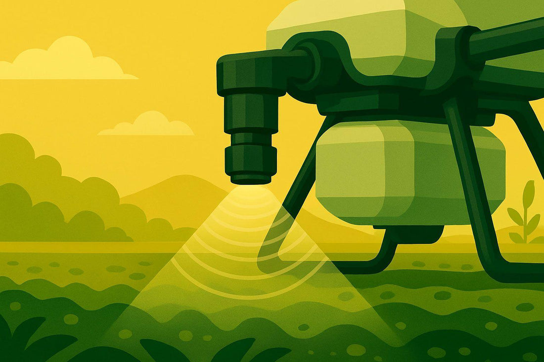
Drone Sensors for Soil and Moisture Mapping
Share
Drones equipped with sensors are transforming farming by providing precise soil and moisture data. This helps farmers make smarter decisions about irrigation, planting, and fertilizer use, potentially increasing crop yields by up to 30% while cutting water usage by 20–50%. Here's how the three main types of sensors work:
- RGB Sensors: Affordable and easy to use, these capture visible light to monitor surface soil moisture and crop conditions. Ideal for beginners or budget-conscious farmers.
- Thermal Sensors: Detect temperature differences to identify moisture issues and crop stress early. Great for irrigation management and larger fields.
- Multispectral Sensors: Offer detailed insights into soil and crop health by analyzing visible and near-infrared light. Best for farmers seeking advanced data on nutrient deficiencies, diseases, and pest issues.
Each sensor type has strengths and limitations, so choosing the right one depends on your specific farming needs, budget, and technical expertise. With drone technology advancing and becoming more affordable, these tools are becoming essential for modern agriculture.
Elevate Your Agriculture Soil Analysis with Drones | Drones Tech Lab
1. RGB Sensors
RGB sensors capture visible light, making them an accessible tool for drone-based soil and moisture mapping. By recording red, green, and blue data, these sensors produce color images that reveal soil conditions - wet soil tends to appear darker, while dry soil looks lighter.
Measurement Accuracy
RGB sensors have shown impressive accuracy in soil moisture analysis. For instance, a 2023 student research project at Global Impact STEM Academy found that RGB sensors achieved an average correlation coefficient of 0.865 when assessing soil moisture in a harvested cornfield. Notably, the green channel alone reached a correlation of 0.955, outperforming multispectral sensors (0.063) and thermal sensors (0.097). Further advancements are possible by integrating RGB data with machine learning. In Baghdad, Iraq, researchers used a Nikon D5300 RGB camera paired with artificial neural networks to predict irrigation needs, achieving extremely low mean square errors during training, testing, and validation.
Area Coverage
One of the strengths of RGB sensors is their ability to cover large areas efficiently. At Virginia Tech's Tidewater Agricultural Research Extension Center, researchers used a Mavic 3T drone equipped with an RGB camera to survey cornfields. Flying at 65 feet with an 85% overlap, the drone covered an area of approximately 328 by 164 feet in just 15–20 minutes. The resulting high-resolution images (8,000 x 6,000 pixels) and an 84° field of view provided a ground sampling distance of about 0.4 inches per pixel. This level of detail allowed researchers to capture subtle variations in soil moisture across the field and generate detailed orthomosaics and digital surface models.
Depth of Analysis
Although RGB sensors primarily offer surface-level insights, they are highly effective for estimating soil moisture by analyzing color differences. These sensors can pinpoint areas that may need irrigation and serve as input for neural networks to predict irrigation requirements with notable precision. When combined with other data sources, such as weather information or thermal imagery, RGB data can significantly improve soil moisture estimates. Consistent flight planning and stable lighting conditions further enhance the reliability of the collected data.
Cost
RGB sensors are the most budget-friendly option for drone-based soil monitoring. Basic sensors cost as little as $1–2, while professional-grade systems offer excellent functionality for farms of all sizes. These sensors are easy to integrate with existing drone platforms and require minimal training, enabling farmers to generate on-site data quickly for time-sensitive decisions.
Thermal sensors, which capture temperature variations, can further enhance soil moisture mapping when used alongside RGB sensors.
2. Thermal Sensors
Thermal sensors play a crucial role in precision agriculture, complementing RGB sensors by offering unique insights. These sensors detect temperature variations across a field, making them especially useful for mapping soil moisture. The principle is simple: wet soil stays cooler than dry soil. By capturing these temperature differences, thermal sensors help farmers identify moisture patterns that aren’t visible to the naked eye.
Measurement Accuracy
Thermal sensors shine when it comes to spotting problems early - before they become visible. Unlike RGB sensors, which rely on color changes, thermal sensors capture subtle shifts in temperature with high precision. Soil temperatures generally range between 14°F and 122°F, and these sensors are designed to measure those variations accurately.
This technology is particularly effective for managing irrigation and detecting crop stress. For example, stressed plants often show higher temperatures compared to healthy ones. By identifying these differences early, farmers can take action to minimize losses caused by moisture-related stress. The detailed, accurate data these sensors provide is a game-changer for large-scale monitoring.
Area Coverage
Mounted on drones, thermal sensors can efficiently survey vast areas of farmland. Fixed-wing drones equipped with thermal cameras are ideal for large-scale operations, thanks to their extended flight times. For instance, the Quantum Systems Trinity F90+ Thermal offers up to three hours of flight endurance, allowing it to survey thousands of acres in a single flight. Some agricultural drones can map as much as 500 acres daily, making them a practical choice for farms of all sizes.
Depth of Analysis
Thermal sensors go beyond surface-level observations, offering insights into subsurface irrigation issues that other sensors might miss. By creating detailed irrigation performance records, they help farmers assess system effectiveness and make informed decisions for future planting seasons. Additionally, thermal imagery can detect early signs of pest outbreaks and assess crop maturity by identifying temperature anomalies linked to plant stress. This adds another layer of valuable data to RGB sensor outputs, creating a more complete picture for soil and moisture management.
Cost
Thermal sensors fall into the mid-range category in terms of cost for drone-based soil monitoring. Professional-grade thermal cameras typically range from $7,000 to $20,000. For farmers opting for thermal soil moisture mapping services, costs are projected to be between $7 and $15 per acre by 2025.
| Service Type | Estimated Cost per Acre |
|---|---|
| Thermal Soil Moisture Mapping | $7–$15 |
| Crop Monitoring (Multispectral) | $5–$10 |
| AI-Driven Disease Prediction | $15–$30 |
While the initial investment may seem steep, the benefits - such as early problem detection and extensive field coverage - make it worthwhile. Plus, with advancements in technology, the cost of agriculture drone services is expected to drop by 30% in 2025, making thermal sensing more affordable for farms of all sizes.
For even deeper agricultural insights, multispectral sensors offer another layer of analysis, capturing data across multiple wavelengths to complement thermal sensor data.
sbb-itb-3b7eef7
3. Multispectral Sensors
Multispectral sensors take drone-based soil and moisture mapping to the next level by capturing data beyond the visible spectrum. These sensors detect differences in how crops reflect light across visible and near-infrared (NIR) wavelengths, making them a powerful complement to RGB and thermal sensors in precision agriculture.
Unlike standard RGB cameras, which capture only three color bands, multispectral sensors typically include at least one additional band in the red region (around 660–680 nm). This band corresponds to the chlorophyll-a absorption feature in plants, giving farmers an early warning system for potential issues that might not yet be visible to the naked eye.
Measurement Accuracy
When it comes to predicting soil moisture, multispectral sensors deliver highly detailed and reliable results. A study published in August 2024 showed that combining UAV-based multispectral images with machine learning algorithms produced impressive accuracy, especially for surface soil moisture. For instance:
- Surface soil moisture analysis using blue band reflectance and linear regression achieved an R² of 0.89 and an RMSE of 2.80%.
- At a depth of 5 cm, using the Ratio Vegetation Index (RVI), the results showed an R² of 0.64 and an RMSE of 3.03%.
These sensors excel in surface-level measurements, though their performance decreases slightly for deeper layers. Their ability to capture detailed reflectance data also helps identify early signs of nutrient deficiencies, diseases, and pest problems.
Area Coverage
Multispectral sensors provide exceptional spatial coverage, making them ideal for large-scale field monitoring. Mounted on drones, they can quickly survey vast areas while capturing fine spatial details within fields. With resolutions as sharp as 2 cm at 60 meters altitude, these sensors can deliver precise soil moisture predictions for expansive farmlands. Unlike satellite-based methods, which may only revisit a field every few days or weeks, drones equipped with multispectral sensors can be deployed as needed, offering real-time insights for timely decision-making. This capability helps farmers respond proactively to changing conditions.
Depth of Analysis
The data from multispectral sensors is used to create detailed maps of soil moisture content, helping farmers pinpoint areas with either too much or too little moisture. This information supports a range of applications, such as irrigation management, yield forecasting, vegetation health monitoring, crop rotation planning, frost detection, and pest control. While these sensors are excellent for surface and shallow subsurface analysis, their effectiveness can be limited by factors like soil penetration depth and dense vegetation cover.
Cost
Investing in multispectral sensors is a significant financial commitment, but the value they bring to precision agriculture can make them worth the expense. Entry-level systems, such as the DJI Mavic 3 Multispectral, start at around $4,600. Mid-range options like the MicaSense RedEdge-P and the Sentera 6X Multispectral system are priced between $8,000 and $12,000. High-end platforms, such as the MicaSense Altum-PT, can exceed $20,000. While the upfront cost is steep, the actionable insights from multispectral data often lead to better resource management, reducing waste in water, fertilizers, and pesticides. These savings can help offset the initial investment within a few growing seasons.
For farmers aiming to gain deeper insights into soil and crop health, multispectral sensors offer a level of detail that supports smarter, more efficient decision-making in agriculture.
Advantages and Disadvantages
Different types of sensors bring their own set of strengths and challenges to soil moisture mapping, helping farmers decide which tool best fits their needs.
| Sensor Type | Advantages | Disadvantages |
|---|---|---|
| RGB Sensors | • Affordable and widely available • Easy to use and integrate • Simple image interpretation, great for basic field checks • Can identify crop diseases, nutrient deficiencies, and weeds • Provides high-resolution visual data |
• Limited to visible light detection • Cannot detect early stress indicators • Less accurate for detailed soil moisture analysis • Weather can impact image quality • Complex issues may require manual interpretation |
| Thermal Sensors | • Detects water stress before visible symptoms emerge • Works well in various lighting conditions • Offers near real-time monitoring • Useful for fine-tuning irrigation schedules • Mid-range investment option |
• Requires complex data processing and specialized software • Environmental factors can sometimes affect accuracy |
| Multispectral Sensors | • Provides precise soil moisture mapping and crop health insights • Detects subtle changes invisible to the human eye • Covers large areas efficiently • Supports a wide range of farming applications |
• Higher upfront costs • Requires advanced data processing and training |
The table highlights the key benefits and drawbacks of each sensor type, but practical use also depends on costs and data management needs. For instance, RGB sensors are ideal for farmers exploring drone technology on a budget, while multispectral sensors can reduce fertilizer and pesticide use by as much as 30%. With the agricultural drone market poised for rapid growth, these technologies are becoming indispensable for improving farm efficiency.
Operational efficiency is another critical factor. RGB sensors deliver instantly usable images, making them perfect for quick field monitoring. On the other hand, thermal and multispectral systems require advanced software and expertise, but they offer game-changing insights. Companies like AgriSenAI have made strides in speeding up data processing, easing the learning curve for these advanced tools.
Ease of integration also varies. RGB sensors are user-friendly and compatible with most agricultural drones, requiring minimal training. Thermal and multispectral systems, while more complex, provide actionable insights that can significantly impact precision farming - such as increasing crop yields by up to 25% through early disease detection.
For farmers looking for a quick and straightforward solution, RGB sensors are a great choice for aerial monitoring. Those focused on improving irrigation efficiency may benefit most from thermal sensors, while multispectral systems are ideal for those seeking a detailed understanding of crop health and soil conditions.
Conclusion
Choosing the right sensor depends on your farming goals, budget, and level of technical know-how. RGB sensors are a great starting point for those new to drone technology or looking for basic field assessments. They’re affordable and provide quick visual insights. Thermal sensors, on the other hand, are perfect for managing irrigation, detecting water stress early, and improving water usage. They come at a moderate price point but deliver significant benefits for water efficiency. For those seeking the most detailed analysis, multispectral sensors stand out. They offer deep insights into soil and crop health, potentially cutting fertilizer and pesticide use by up to 30%, making them ideal for larger farms willing to invest in advanced tools.
These sensor options bring precision and efficiency to farm management. With the agricultural drone market expected to hit $18.22 billion by 2030, it’s clear that these technologies are becoming indispensable. Whether you opt for RGB simplicity, thermal efficiency, or multispectral depth, aligning your choice with your farm’s needs and capabilities is crucial.
For farmers ready to take the leap into drone-based soil and moisture mapping, Drone Spray Pro offers comprehensive support. From FAA licensing to training and expert advice, they ensure you maximize the potential of your chosen sensor technology. It’s not just about gathering data - it’s about turning that data into real improvements for your farm’s productivity.
FAQs
How can I choose the right drone sensor for soil and moisture mapping on my farm?
Choosing the right drone sensor comes down to your farm's specific requirements and budget. Start by pinpointing your objectives - are you looking to monitor soil nutrients, measure moisture levels, or evaluate crop health? If you're aiming for in-depth soil and crop analysis, multispectral sensors are an excellent option. For detecting moisture, thermal sensors work well and are often a more affordable choice. If your focus is on basic visual mapping, RGB cameras offer a straightforward solution.
When deciding, think about the level of precision you need, the size of your farm, and how much you're prepared to spend. Striking the right balance between cost, accuracy, and coverage will guide you to the best choice for your needs.
What challenges should I consider when using drone sensors for soil and moisture mapping on my farm?
Integrating drone sensors into farming comes with its share of hurdles. For starters, the upfront costs of drones and sensors can be steep, which might make some farmers hesitate. On top of that, short battery life and limited flight durations can restrict how much ground you can cover in one go. And let’s not forget about FAA regulations - navigating these rules, especially for commercial drone use, can take extra time and effort.
Then there's the challenge of handling the massive amounts of data these drones collect. Without the right tools or know-how, turning that data into actionable insights can feel overwhelming. Plus, if you're new to drone technology, there might be a learning curve, and you could need some training to fully tap into their potential for tasks like soil and moisture mapping.
The good news? With the right investments in equipment, software, and training, these obstacles can be tackled, making drones a valuable addition to modern farming.
How can drone sensors for soil and moisture mapping help improve crop yields and manage resources on my farm?
Drones equipped with sensors like RGB, thermal, and multispectral cameras offer farmers detailed, real-time insights into critical factors such as soil moisture, plant health, and stress levels. This wealth of information empowers farmers to make well-informed, precise decisions about irrigation, fertilization, and overall crop care.
By pinpointing specific areas in a field that need more or less water or nutrients, farmers can cut down on waste, conserve resources, and improve crop yields. This focused strategy boosts efficiency and promotes sustainable farming, helping to increase productivity while reducing environmental strain.